Your new post is loading...
The accuracy of some critical GPS navigation systems used in modern farming have been "extremely compromised," a John Deere dealership told customers Saturday.
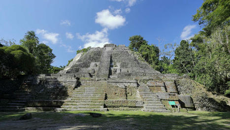
Avec les technologies spatiales et aériennes, les recherches archéologiques font des progrès considérables dans des régions parfois austères. Une équipe de chercheurs s’est basée su
Searching for stories from space: Journalists from the Americas create guide to analyze satellite images with artificial intelligence Innovation. Latin American Journalism Review by The Knight Center at The University of Texas at Austin.
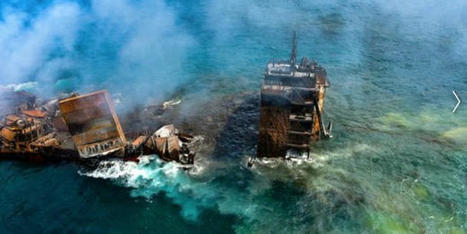
L'intelligence artificielle pourrait faciliter la prévention des catastrophes maritimes. À Toulouse, l'IRT Saint-Exupéry vient d'être sélectionné par l'Agence spatiale européenne pour faire appel de manière frugale aux algorithmes afin de détecter sur les images satellites des marées noires ou des prolifération d'algues nocives et envoyer quasiment en temps réel des alertes.
This is the story of how Google Search died, and the people responsible for killing it.
The story begins on February 5th 2019, when Ben Gomes, Google’s head of search, had a problem. Jerry Dischler, then the VP and General Manager of Ads at Google, and Shiv Venkataraman, then
The benefits of buying space companies to pursue vertical integration are becoming less apparent in the current economic climate.
SpaceX celebrates the satellite business as a money-making venture fueling a quest to launch rockets and reach Mars.
SpaceX's move into EO could present a big challenge to companies selling space data already.
A Ukrainian military source believes that Russia’s long-range strikes are aimed using satellite imagery provided by U.S. companies.
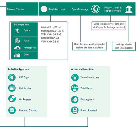
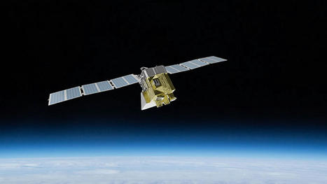
ESA’s latest Third Party Missions Data Access Guide has been published, providing technical details and information on available data collections for all current or past Third Party Missions.
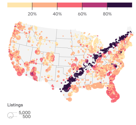
MethaneSAT will circle the Earth 15 times a day, identifying emission sources and their rates
|
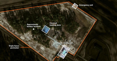
A New York Times analysis shows security upgrades unique to Russian nuclear storage facilities at a Cold War-era munitions depot.
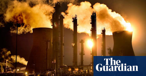
Use of enclosed combustors leaves regulators heavily reliant on oil and gas companies’ own flaring data
Trajectory is the official publication of the United States Geospatial Intelligence Foundation (USGIF) – the nonprofit, educational organization supporting.
Quelle est la consommation d'une requête sur ChatGPT ? Combien de CO2 est émis pour générer une image avec une IA ? J'ai compilé toutes les données concrètesà disposition pour mieux cerner les enjeux et les usages.
A newly energized Russia is already escalating grey-zone operations in Eastern Europe, says Estonia’s defense minister.
The origins of geospatial intelligence (GEOINT) can be traced back to the early days of aerial photography and reconnaissance during World War I and World War II. Military leaders recognized the immense value of capturing images of enemy positions, fortifications, and troop movements from the air. This visual intelligence provided a significant tactical advantage on…
La France est une nation maritime. La stabilité de son économie nationale, de son commerce et de sa sécurité est intrinsèquement liée à la nature maritime du commerce international.
The National Labor Relations Board alleges that SpaceX "interfered with, restrained and coerced its employees"
Operators are developing creative solutions for putting AI on satellites, a challenge that comes with myriad technical and logistical obstacles.
In the ever-evolving landscape of intelligence gathering, satellite imagery has emerged as a pivotal tool in the realm of open source intelligence (OSINT). As technology advances and access to high-resolution satellite data becomes more widespread, the role of satellite imagery in OSINT continues to expand, revolutionizing the way intelligence is collected, analyzed, and disseminated.
|